 |
|
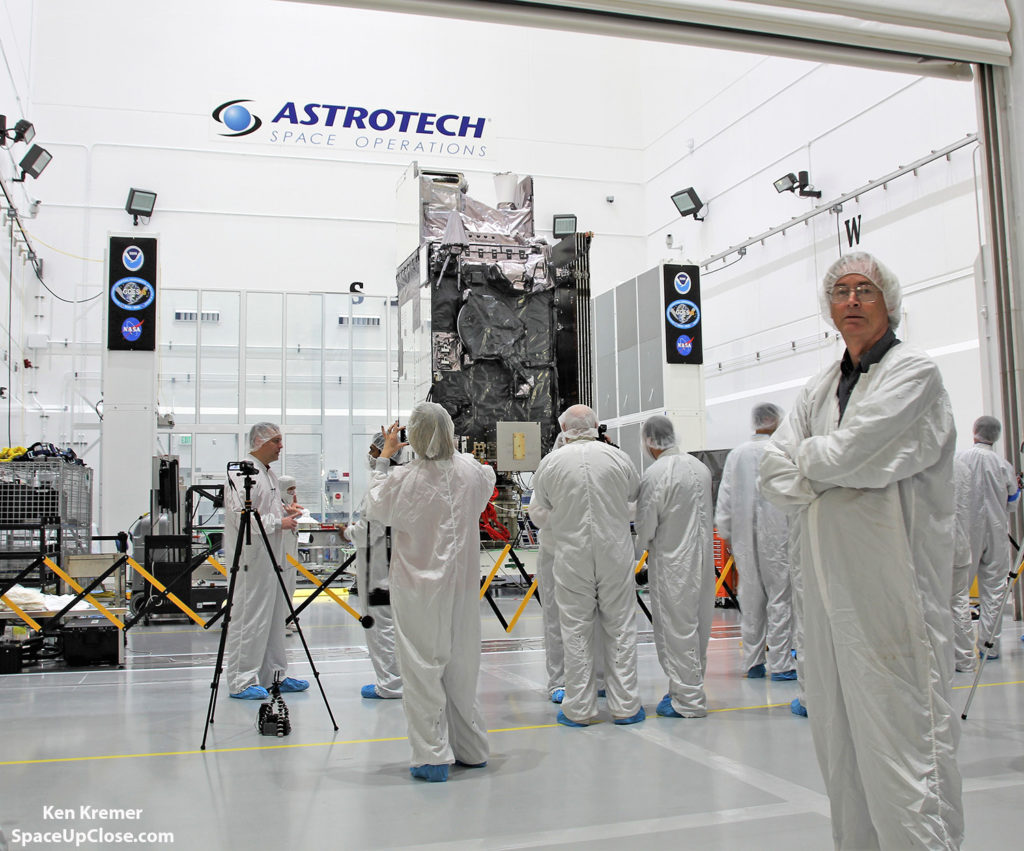
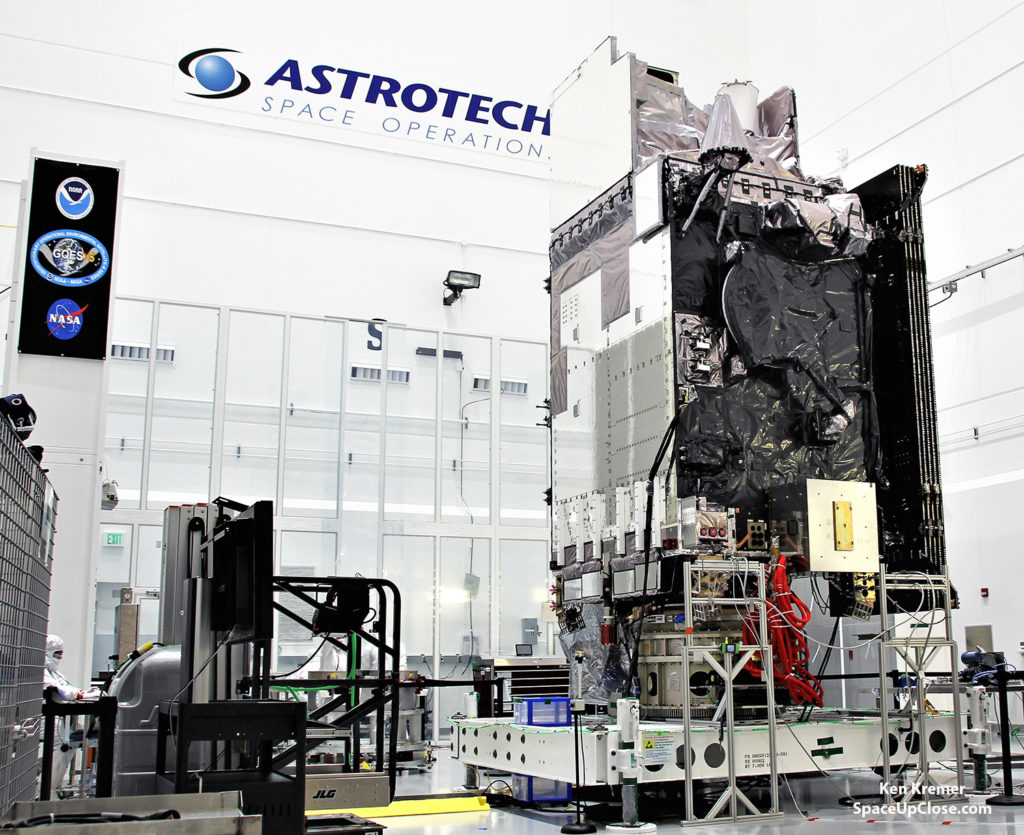
The NASA/NOAA Geostationary Operational Environmental
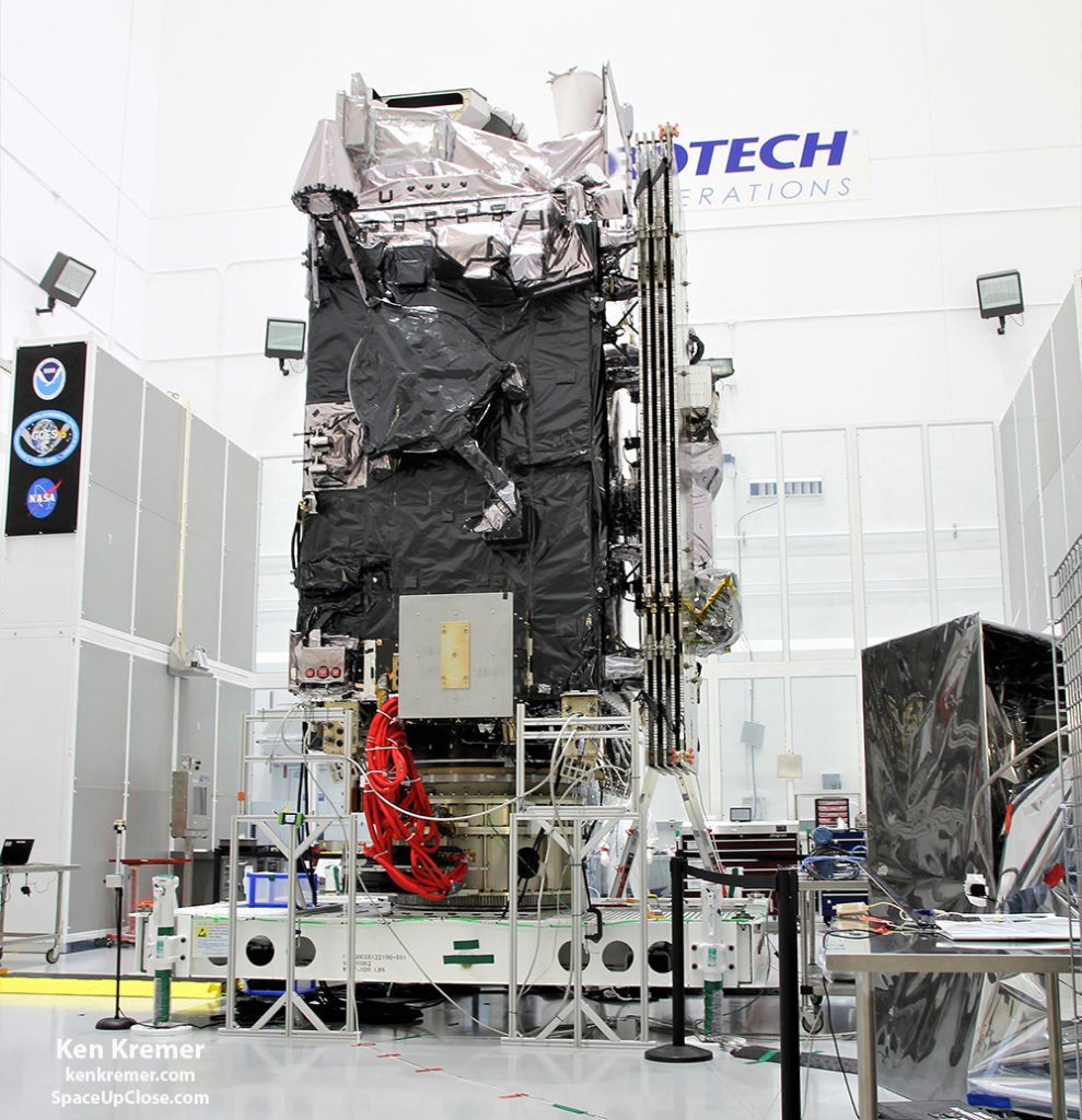
Satellite-S (GOES-S) is being processed in the clean room at Astrotech Space Operations, in Titusville, FL, on Jan. 16, in advance of nose cone encapsulation for planned launch on a ULA Atlas V slated for Mar. 1, 2018. GOES-S belongs to new constellation of America’s most advanced weather satellites. Credit: Ken Kremer/SpaceUpClose.com/kenkremer.com |
the game changing NASA/NOAA next generation GOES-S geostationary weather
observation satellite offering a “dramatic leap in capability” for the western
United States is on track for this week, Thursday, Mar. 1 from the Florida
Space Coast and will complete the initial upgrade in the US weather fleet.
observatory GOES-R, which recently became operational for the eastern US, and thereby
complete the equally dramatic three decade leap in weather satellite capability
impacting the entire continental US as well as Hawaii and Alaska –
from an orbital perch 22,200 mi (35800 km) above Earth.
close look and media briefing about the massive 5.5 ton observatory inside the
cleanroom processing facility at Astrotech Space Operations in Titusville, Fl, where
we media participants dressed in protective gowns to keep the spacecraft free
of dirt, grime and germs from the human workers and visitors to prevent any
degradation in data gathering by the state of the art science instruments and keep them in tip top shape.
constellation of powerful weather satellites in the advanced GOES-R series that
“are bringing the nation a new capability .. that’s a dramatic leap .. to scan
the entire hemisphere in about 5 minutes,” the NOAA GOES-S team said during a
briefing in the Astrotech cleanroom. “It’s a very exciting time.”
GOES-R series] has both weather and space weather detection capabilities!” Tim
Gasparrini, GOES-S program
manager for Lockheed Martin, told Space Up Close during a cleanroom interview
at Astrotech.
observation satellite is scheduled for March 1, 2018, near sunset at 5:02 p.m. EST aboard a United Launch Alliance
(ULA) Atlas V rocket from Space Launch Complex-41 on Cape Canaveral Air Force
Station in Florida.
hours from 5:02 – 7:02 p.m. EST.
 |
|
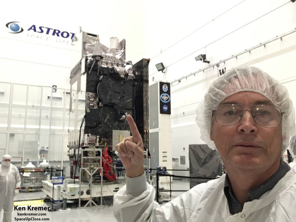
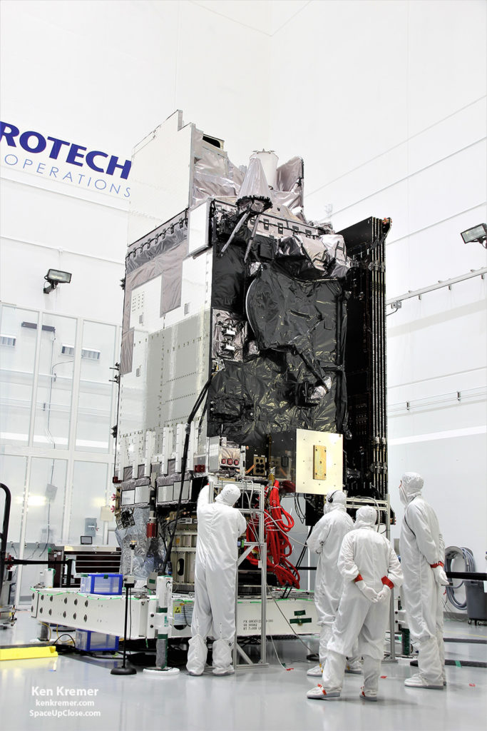
The NASA/NOAA Geostationary Operational Environmental
Satellite-S (GOES-S) is being processed by technicians and engineers in the clean room at Astrotech Space Operations, in Titusville, FL, on Jan. 16, in advance of nose cone encapsulation for planned launch on a ULA Atlas V slated for Mar. 1, 2018. GOES-S belongs to new constellation of America’s most advanced weather satellites. Credit: Ken Kremer/SpaceUpClose.com/kenkremer.com |
GOES-S, which stands for Geostationary
Operational Environmental Satellite–S, is a new and advanced transformational
weather satellite that will vastly enhance the quality, speed and accuracy of
weather forecasting available to forecasters for Earth’s Western Hemisphere.
said Secretary of Commerce Wilbur Ross, in a statement. “The latest GOES
addition will provide further insight and unrivaled accuracy into severe
weather systems and wildfires in the western United States.”
Lockheed Martin Space Systems,
Littleton, Colorado. It was flown cross country aboard a U.S. Air Force C-5M Super Galaxy cargo transport
and arrived at NASA’s Kennedy Space Center Shuttle Landing Facility on Dec. 4,
2017.
at KSC the 11,400 pound (5100 kg) GOES-S spacecraft was then transported by
truck to Astrotech
Space Operations in Titusville, Florida for some two months of processing by
engineers and technicians at Astrotech.
carried out additional testing, check out and verification of the spacecraft
systems and science instruments by technicians working inside the huge high bay
cleanroom
processing facility at Astrotech. After
all that work was satisfactorily completed the probe was encapsulated inside
the Atlas rockets payload fairing halves.
Astrotech is located just a few
miles down the road from NASA’s Kennedy Space Center and the KSC Visitor
Complex housing the finest exhibits of numerous spaceships, hardware items and
space artifacts.
 |
|
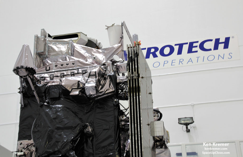
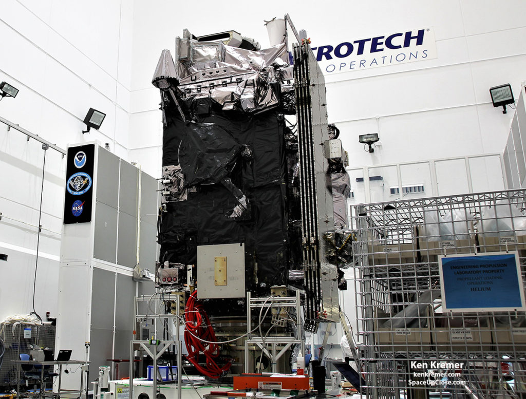
The NASA/NOAA Geostationary
Operational Environmental Satellite-S (GOES-S) is being processed in the clean room at Astrotech Space Operations, in Titusville, FL, on Jan. 16, in advance of planned launch on a ULA Atlas V slated for Mar. 1, 2018. GOES-S belongs to new constellation of America’s most advanced weather satellites. Credit: Ken Kremer/SpaceUpClose.com/kenkremer.com |
Program (GOES) system consists of a series of geostationary
weather observation satellites orbiting more than 22,000 miles above Earth developed for the nation as part of a cooperative joint effort between NASA and the National Oceanic and Atmospheric
Administration (NOAA).
GOES-R series of America’s most powerful and most advanced next generation geostationary weather observation
satellites. It is designed to last for a
15 year orbital lifetime and will deliver a ‘quantum leap’ in weather
forecasting.
called GOES-R went through a similar processing phase at Astrotech as I
observed in the Astrotech cleanroom at that time in September 2016.
a ULA Atlas V on Nov.
19, 2016.
 |
|
The NASA/NOAA Geostationary
Operational Environmental Satellite-S (GOES-S) is being processed in the clean room at Astrotech Space Operations, in Titusville, FL, on Jan. 16, in advance of planned launch on a ULA Atlas V slated for Mar. 1, 2018. GOES-S belongs to new constellation of America’s most advanced weather satellites. Credit: Ken Kremer/SpaceUpClose.com/kenkremer.com |
weather detection capabilities!” Tim Gasparrini told Space UpClose during a cleanroom
interview.
they will “significantly improve the detection and observation of environmental
phenomena that directly affect public safety, protection of property and the
nation’s economic health and prosperity,” according to a NASA/NOAA description.
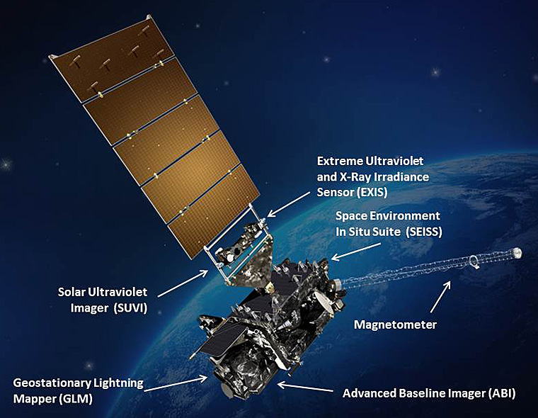
science suite includes the Advanced Baseline Imager (ABI), Geostationary Lightning Mapper (GLM),
Solar Ultraviolet Imager (SUVI), Extreme Ultraviolet and X-Ray Irradiance
Sensors (EXIS), Space Environment In-Situ Suite (SEISS), and the Magnetometer
(MAG).
primary instrument and will collect 3
times more spectral data with 4 times greater resolution and scans 5 times
faster than ever before – via the primary Advanced Baseline Imager (ABI)
instrument – compared to the current GOES satellites.
was, viewers will see weather as it is.
scan the full hemispheric disk in 26 minutes, the new GOES-ABI can
simultaneously scan the Western Hemisphere every 15 minutes, the Continental
U.S. every 5 minutes and areas of severe weather every 30-60 seconds.
are designated with a letter prior to launch and a number once they achieve
geostationary orbit.
first satellite in the series, was renamed GOES-16. GOES-16 recently took its
place as NOAA’s GOES-East satellite, “keeping an eye on the continental United
States and the Atlantic Ocean.”
geostationary orbit the name will chance and it
will be known as GOES-17 and GOES-West. TV viewers are presently accustomed to
seeing daily streams of imagery from the GOES-East and GOES-West weather
observation satellites currently in orbit.
checkout, GOES-17 will become operational as GOES-West, providing coverage of
the western U.S., Alaska, Hawaii and the Pacific Ocean.
GOES-17 will join GOES-16/GOES-East to give the Western Hemisphere two
next-generation geostationary environmental satellites. Together, GOES-16 and
GOES-17 will observe Earth from the west coast of Africa all the way to Guam.
 |
|
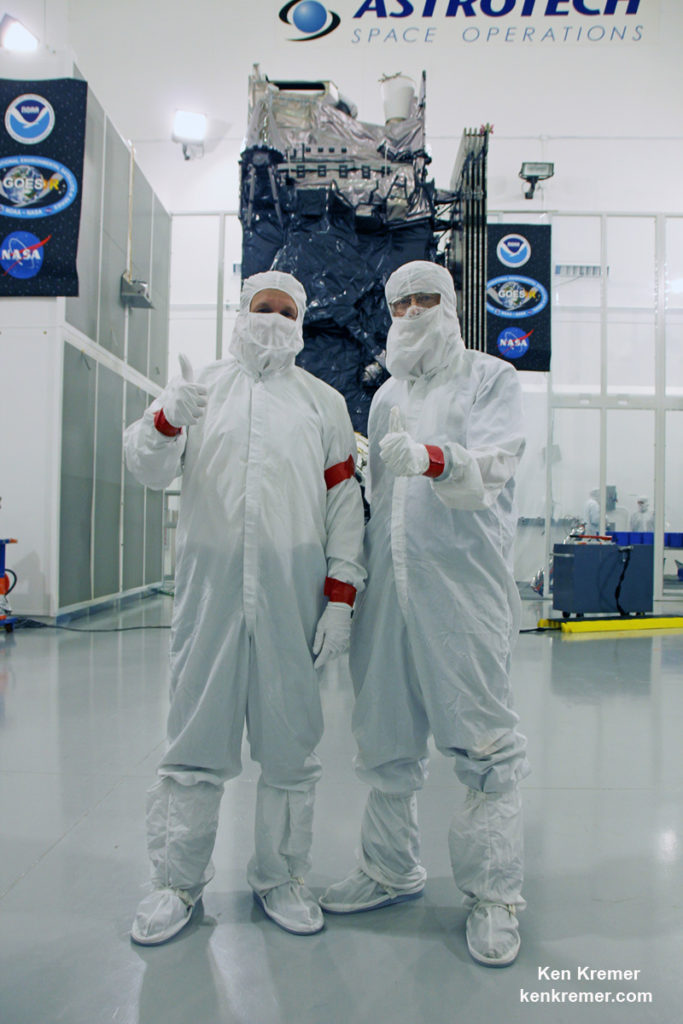
The NASA/NOAA/Lockheed Martin/Harris
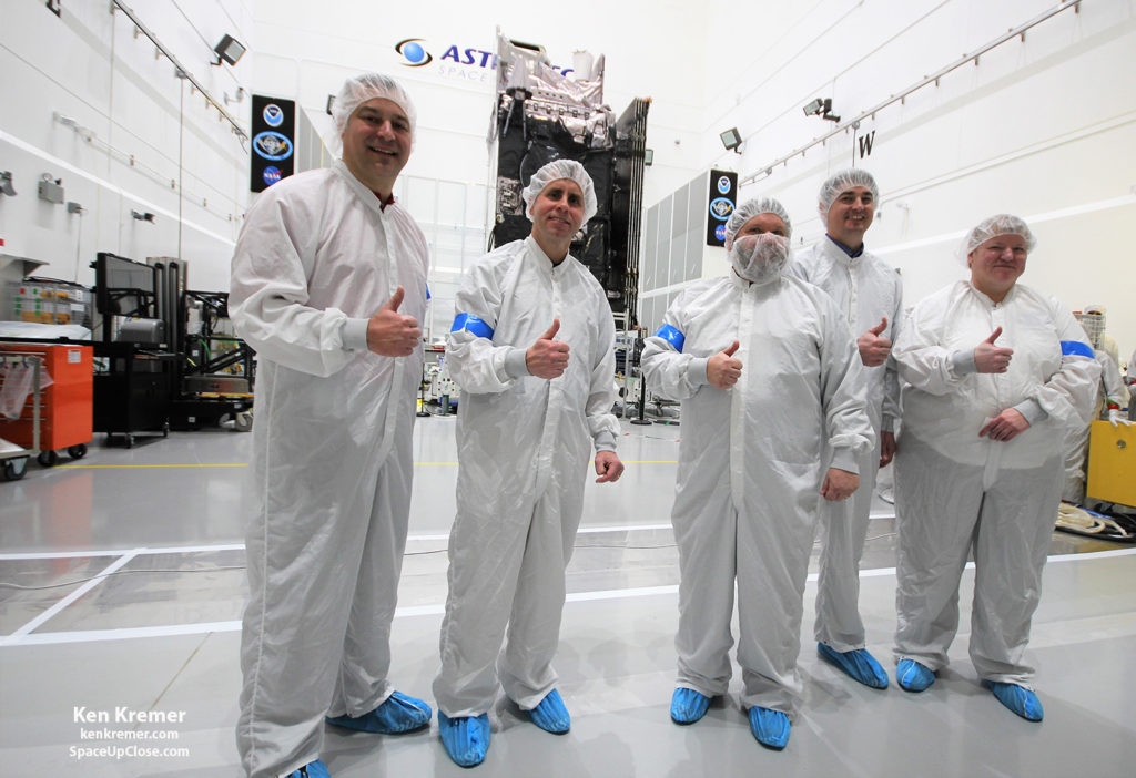
GOES-S team gives a big thumbs up for the dramatic leap in capability this next gen weather observation satellite will provide to the Western US – during media briefing at Astrotech Space Operations, in Titusville, FL on Jan. 16, 2018. Ken Kremer/SpaceUpClose.com/kenkremer.com |
What’s the big deal about GOES-R/GOES-S?
newly upgraded GOES-16/GOES-East, audiences will notice big changes from GOES-S
once it becomes operational because it will provide images of weather patterns
and severe storms as regularly as every five minutes or as frequently as every
30 seconds.
forecasts, severe weather outlooks, watches and warnings, lightning conditions,
maritime forecasts and aviation forecasts.”
forecasting, such as in seasonal predictions and drought outlooks. In addition,
space weather conditions will be monitored constantly, including the effects of
solar flares to provide advance notice of potential communication and
navigation disruptions. It also will assist researchers in understanding the
interactions between land, oceans, the atmosphere and climate.”
NOAA GOES-S team explained during the
Astrotech cleanroom briefing.
years of intense work for the great team of NOAA and NASA and our contractors
Lockheed Martin and Harris.”
capability. The GOES program has been
around for about 40 years and most every American sees it every night on the
weather broadcasts when they see the satellite imagery. And what’s really exciting is that for the
first time in that 40 years we are really end to end replacing the entire GOES system.
The weather community is really excited about what we are bringing.”
– like moving from black and white TV to HDTV.”
hemisphere in about 5 minutes and do things so much faster with double the
resolution.”
school bus sized satellite is equipped with
a suite of six instruments or sensors that are the most advanced of their kind.
They will be used for three types of observations: Earth sensing, solar imaging, and space
environment measuring. They will point
to the Earth, the Sun and the in-situ environment of the spacecraft.
Baseline Imager (ABI), Geostationary Lightning Mapper (GLM), Solar Ultraviolet Imager (SUVI), Extreme
Ultraviolet and X-Ray Irradiance Sensors (EXIS), Space Environment In-Situ
Suite (SEISS), and the Magnetometer (MAG).
are on the top of the spacecraft – namely ABI and GLM.
premier instrument on the spacecraft. When you turn on the news and see a
severe storm picture, that’s the one it comes from. It takes pictures in the
visible as well as the infrared (IR), near infrared (IR),” said Gasparrini.
for things like moisture, vegetation, aerosols and fire. So it looks across a
broad spectrum to determine the environmental conditions on Earth.”
resolution and scans 5 times faster than ever before, compared to the current
GOES satellites.
with 16 different spectral bands (compared to five on current/legacy GOES),
including two visible channels, four near-infrared channels, and ten infrared
channels, according to the mission fact sheet.
ever operational lightning mapper ever flown in space – GLM – built by Lockheed
Martin. The first one was on the GOES-R twin
sister observatory. It has a
single-channel, near-infrared optical transient detector.
in space and at geostationary orbit.”
the Earth 500 times per second. And it compares those images for a change in
the scene that can detect lightning, using an algorithm,” Gasparrini told me.
is a precursor to severe weather. So they are hoping that GLM will up to double
the tornado warning time. So instead of
10 minutes warning you get 20 minutes warning,
for example.”
(in-cloud, cloud-to-cloud and cloud-to-ground) activity continuously over the
Americas and adjacent ocean regions with near-uniform spatial resolution of
approximately 10 km.
are located on a platform that constantly points them at the sun – SUVI (built
by Lockheed Martin) and EXIS. SUVI looks
at the sun in the ultraviolet and EXIS looks at the x-ray wavelengths.”
sun and EXIS measures the intensity of the flare. As it comes towards the Earth, NOAA then uses
the DSCOVR satellite [launched in 2016] as sort of a warning buoy about 30
minutes before the Earth. This gives a warning that a geomagnetic storm is
heading toward the Earth.”
the magnetometer instrument (MAG) on GOES-R then measures the influence of the
magnetic storm on the magnetic field of the Earth.”
charged particle detector, measures the charged particle effect of the storm on
the Earth at geostationary orbit.”
and space weather detection capabilities!” Gasparini elaborated.
 |
|
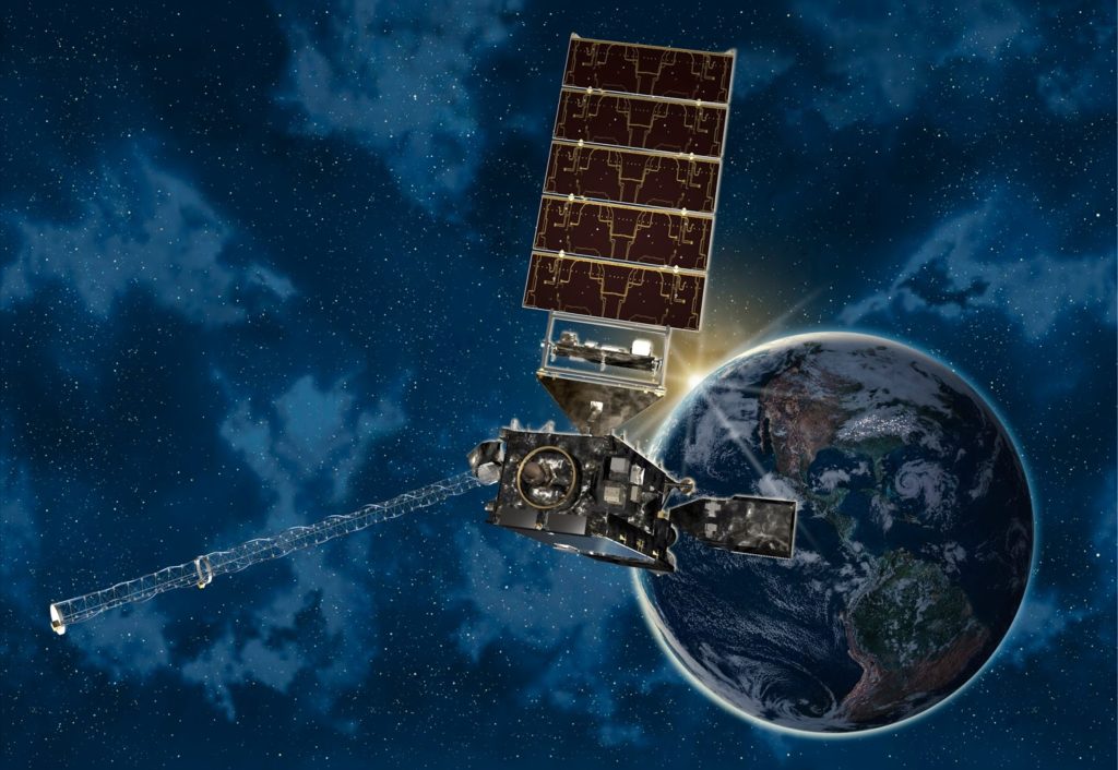
GOES-S weather observation satellite
instrument suite graphic. Credit: NASA/NOAA |
12.8 ft) with a three-axis
stabilized spacecraft bus.
(11,446 lbs) at launch.
are very sensitive to contamination and the team is taking great care to limit
particulate and molecular contaminants in the cleanroom. Some of the instruments have contamination
budget limits of less than 10 angstroms – smaller than the diameter of a
typical molecule. So there can’t even be
a single layer of molecules on the instruments surface after 15 years on
orbit.
also multitask according to a NASA/NOAA factsheet.
every 15 minutes, the Continental U.S. every 5 minutes and areas of severe
weather every 30-60 seconds. All at the same time!”
V in the very powerful 541 configuration, augmented by four solid rocket
boosters on the first stage. The payload
fairing is 5 meters (16.4 feet) in diameter and the upper stage is powered
by a single-engine Centaur.
orbit some 22,300 miles above Earth.
assembled inside the Vertical Integration Facility (VIF) at SLC-41 and will be
rolled out to the launch pad Wednesday morning, Feb. 28 with the GOES-S weather
satellite encapsulated inside the nose cone.
percent chance of favorable weather conditions for Thursday’s near sunset
blastoff.
ULA, Boeing, Lockheed Martin, Orbital ATK and more space and mission
reports direct from the Kennedy Space Center and Cape Canaveral Air Force
Station, Florida.
Stay tuned here for Ken’s continuing
Earth and Planetary science and human spaceflight news: www.kenkremer.com –www.spaceupclose.com –
twitter @ken_kremer – ken
at kenkremer.com
weather satellite launch, SpaceX Falcon Heavy
and Falcon 9 SES-16/GovSat-1 launches on Jan. 30 & Feb. 6, NASA missions,
ULA Atlas & Delta launches, SpySats and more at Ken’s upcoming outreach
events at Kennedy Space Center Quality Inn, Titusville, FL:
Falcon Heavy & Falcon 9 launches, ULA Atlas USAF SBIRS GEO 4 missile
warning satellite, SpaceX GovSat-1, CRS-14 resupply launches to the ISS, NRO
& USAF Spysats, SLS, Orion, Boeing and SpaceX Commercial crew capsules, ,
OSIRIS-Rex, Juno at Jupiter, InSight Mars lander, Curiosity and Opportunity
explore Mars, NH at Pluto and more,” Kennedy Space Center Quality Inn,
Titusville, FL, evenings. Photos for sale


